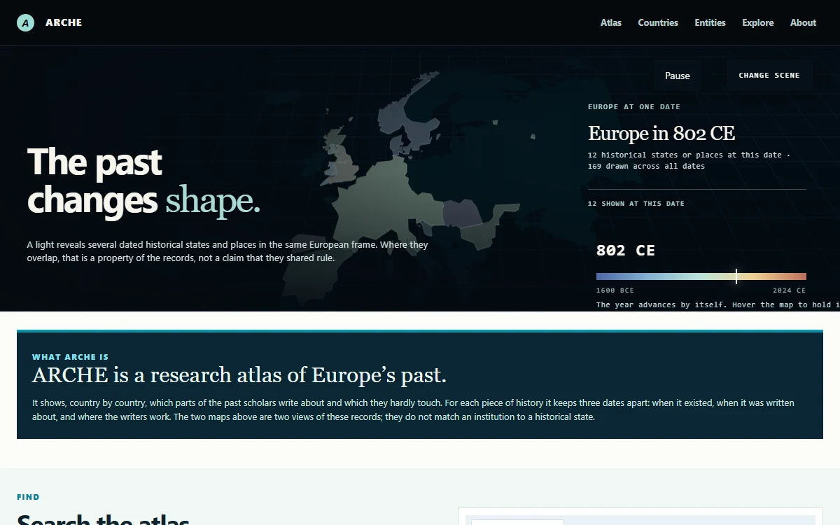
ARCHE — Research Atlas of Europe’s Past
An interactive research atlas connecting historical European entities and territories with OpenAlex scholarly metadata to reveal where, when, and by whom Europe’s past is studied.
ARCHE — Research Atlas of Europe’s Past
ARCHE—Academic Research on Cultures and Heritage in Europe—is an interactive research atlas that asks a deceptively simple question: where is Europe’s past studied today?
Historical atlases normally show where states, polities, or cultures existed. Bibliographic databases show publications, authors, and institutions. ARCHE brings those two worlds into the same research environment without pretending they are the same kind of geography. It connects recorded historical entities and territories with contemporary scholarly metadata to reveal which pasts appear in academic research, where that research is institutionally affiliated, and how attention changes over publication time.
The result is not a conventional map of Europe and not a ranking of countries. It is an instrument for exploring the relationship between historical knowledge and the present-day infrastructure that produces it.
The question behind the project
Research about the European past is not distributed evenly. Some periods and polities have accumulated vast bibliographies, while others remain difficult to find. Some entities are studied across many countries; others appear primarily within a smaller institutional geography. These patterns may reflect language, access to archives, academic traditions, funding, disciplinary boundaries, or simply the limits of the available metadata.
ARCHE makes those patterns visible enough to investigate. It is designed around questions such as:
- Which historical entities are named in research affiliated with a particular country?
- Which present-day research countries publish work connected to a selected historical entity?
- How has attention to that entity changed across publication years or decades?
- Which parts of the declared corpus appear densely studied, and which appear comparatively quiet?
- Where does the dataset have no analysis yet, and where does it have a genuine zero?
That final distinction is fundamental. ARCHE treats missing knowledge as a state that must remain visible. Unknown is not zero.
Three clocks, kept apart
The central intellectual decision in ARCHE is to preserve three independent dimensions instead of collapsing them into one map.
Historical time
This is the period in which a historical entity existed according to the selected source record. A polity may have several dated geometries or territorial slices. These dates describe the source’s historical representation; they do not describe when scholarship about the polity was produced.
Publication time
This is the year in which a scholarly work indexed by OpenAlex was published. Publication time allows the atlas to show changes in recorded academic attention: the growth, decline, persistence, or absence of candidate works associated with an entity.
Affiliation geography
This is the recorded country and location of an author’s institution in OpenAlex. It is a property of scholarly infrastructure. It is not the author’s nationality, the location of the historical event, the cultural ownership of a subject, or the territory once controlled by the historical entity.
Keeping these three clocks separate prevents an attractive visualization from making a false historical claim. The territory of a medieval state and the location of a modern university can appear in the same atlas, but one must never be used as evidence for the other.
flowchart TD;
  H["HISTORICAL TIME — when it existed"];
  P["PUBLICATION TIME — when it was written"];
  A["AFFILIATION GEOGRAPHY — where writers work"];
  B["KEEP SEPARATE — territory is not institution; candidate is not finding"];
  H -. kept separate .-> P;
  P -. kept separate .-> A;
  A --> B;
  classDef history fill:#faf7ef,stroke:#dda63a,stroke-width:3px,color:#10232c;
  classDef publication fill:#d9f1f4,stroke:#0a93ad,stroke-width:3px,color:#10232c;
  classDef affiliation fill:#f1f7f5,stroke:#4c9f38,stroke-width:3px,color:#10232c;
  classDef boundary fill:#0b2633,stroke:#0a93ad,stroke-width:3px,color:#ffffff;
  class H history;
  class P publication;
  class A affiliation;
  class B boundary;
ARCHE’s analytical model. Historical existence, scholarly publication, and institutional affiliation remain separate dimensions.
Two views of the atlas
The opening experience makes this distinction tangible through two switchable 3D scenes.
The historical geography scene advances through time and illuminates dated territories recorded for European entities. Several entities may overlap in the same frame. Those intersections are properties of the underlying source records—not a declaration that the entities shared rule, borders, or political authority.
The research geography scene replaces territories with institutional sites. Each light identifies the recorded main location of an institution, while its visual prominence relates to the candidate works currently associated with that institution. The scene shows where research metadata is anchored, not where history happened.
Moving between these scenes is the conceptual heart of ARCHE: the past changes shape, and so does the geography of inquiry.
Example: in the historical scene, selecting the year 802 CE reveals the territorial records active at that date. Changing to the institutional scene does not reinterpret those territories; it loads a different dataset about present-day research affiliations.
What visitors can explore
ARCHE is structured as a network of complementary entry points rather than a single dashboard.
Atlas overview
The atlas presents coverage, institutions, chronological distributions, and comparisons across the published release. It offers a broad view of how the dataset is shaped before the visitor moves into an individual country or entity.
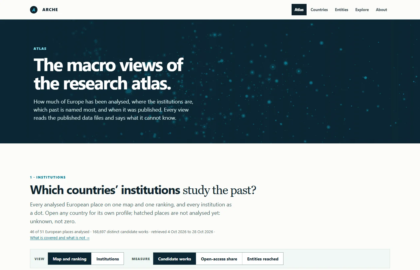
The Atlas overview introduces the published coverage before presenting maps, rankings, institutions, open-access measures, and entities reached. Hatched or unanalysed places remain unknown rather than being assigned a zero.
Countries
Country profiles answer: which parts of the past are named by research affiliated with institutions in this country? They expose candidate entities, publication patterns, institutions, representative evidence, coverage, and the denominators required to interpret comparisons responsibly.
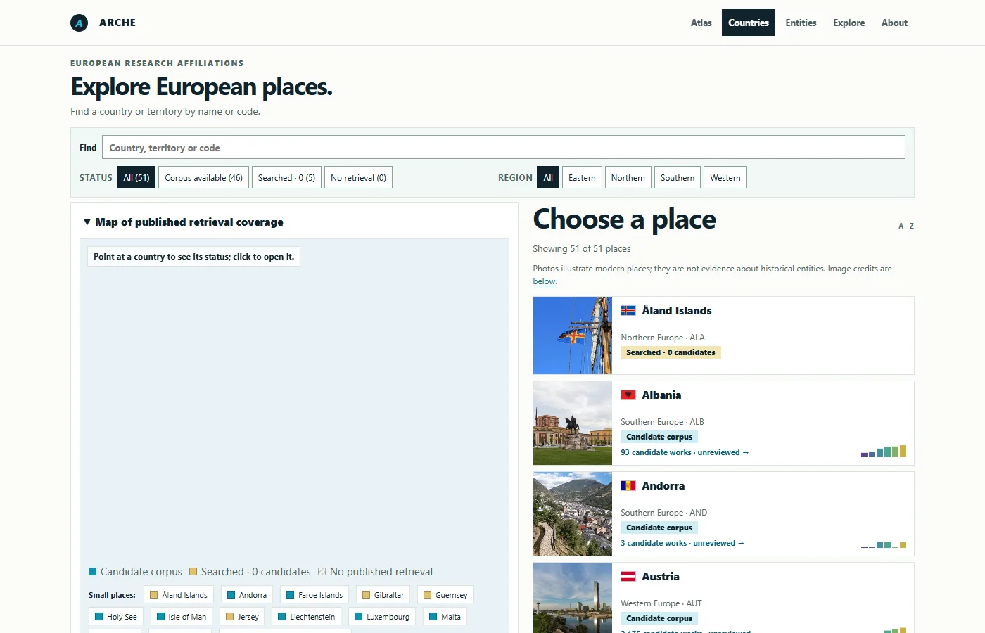
The Countries directory combines a coverage map with searchable place cards. Status labels distinguish analysed places, searches with no candidate retrieval, and places that have not yet been analysed.
Historical entities
Entity profiles reverse the question: which research countries and institutions publish candidate work connected with this historical entity? Each profile keeps historical dates and geometries distinct from the modern research geography and provides provenance for the records it displays.
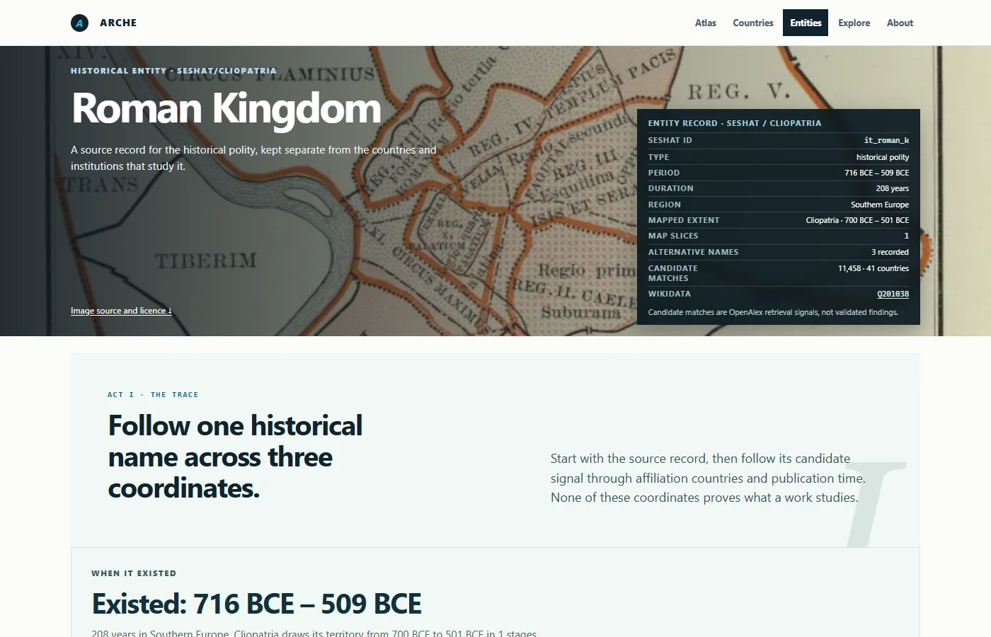
The Roman Kingdom profile begins with the source record and then follows the same name across three coordinates: when the entity existed, where candidate scholarship is institutionally affiliated, and when that scholarship was published.
Search
A unified search connects countries, entities, institutions, and the names used to retrieve them. This is particularly important because historical entities are rarely described by one stable label. Preferred names, alternative names, spellings, and exclusions all affect what the system can find.
Exploratory tools
The Explore section turns the dataset into a set of research questions. Visitors can place a pin in space and time, examine comparatively quiet areas of scholarship, contrast two countries, inspect distances and regions, and follow relationships that are difficult to see in a static table.
These tools do not replace source criticism. They are designed to help a researcher identify where a closer reading may be worthwhile.
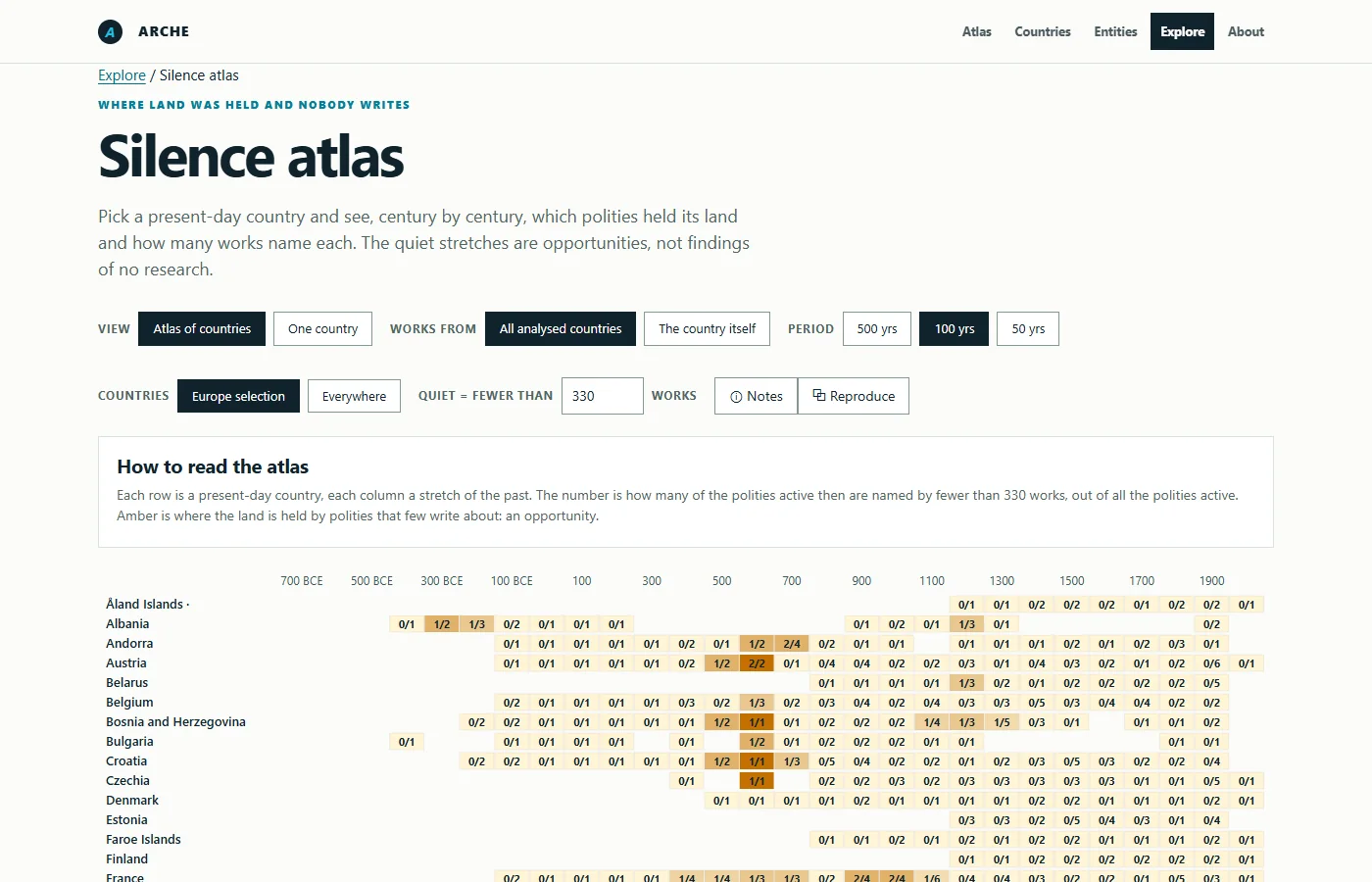
The Silence Atlas looks for quiet stretches in the published candidate corpus. Amber cells identify opportunities for investigation, not proof that nobody has written about a place or polity.
From historical records to research evidence
ARCHE combines several sources, each with a distinct responsibility.
Seshat Global History Databank supplies structured historical information and the controlled vocabulary from which the project defines its historical entities. Cliopatria contributes dated geospatial records used to represent historical coverage. OpenAlex supplies scholarly works, publication years, institutions, affiliations, identifiers, topics, and other bibliographic metadata. Wikidata and Wikimedia Commons support selected contextual images where their provenance and licence can be recorded.
The public atlas currently brings together 202 historical European entities with candidate scholarly evidence. The client is statically built from a versioned release: visitors do not trigger uncontrolled live searches from the browser, and every published profile can expose its source version, retrieval context, method, and limitations.
This separation of ingestion and presentation matters. Raw source responses and analytical state remain in the research pipeline; the website receives optimized, publishable datasets and explicit release metadata.
flowchart TB;
  subgraph SOURCES["SOURCE SYSTEMS"];
    direction TB;
    S["Seshat — entities, names, dates"];
    C["Cliopatria — dated territories"];
    O["OpenAlex — works and affiliations"];
  end;
  N["Reviewed names — aliases and exclusions"];
  R["Human judgment — accept, reject, both, uncertain"];
  V["Versioned release — evidence and provenance"];
  A["Static atlas — unknown stays unknown"];
  S --> N;
  C --> N;
  O --> N;
  N -->|candidate evidence| R;
  R -->|reviewed state| V;
  V --> A;
  classDef source fill:#ffffff,stroke:#dda63a,stroke-width:3px,color:#10232c;
  classDef retrieval fill:#d9f1f4,stroke:#0a93ad,stroke-width:3px,color:#10232c;
  classDef review fill:#faf7ef,stroke:#b48735,stroke-width:3px,color:#10232c;
  classDef release fill:#10232c,stroke:#0a93ad,stroke-width:3px,color:#ffffff;
  classDef atlas fill:#0a93ad,stroke:#087f99,stroke-width:3px,color:#ffffff;
  class S,C,O source;
  class N retrieval;
  class R review;
  class V release;
  class A atlas;
The evidence pipeline. Historical records and scholarly metadata pass through reviewed names, traceable candidate retrieval, human judgment, and a versioned release before reaching the static atlas.
How a candidate match is created
An OpenAlex work becomes a candidate only when the retrieval process finds evidence connecting its title or available abstract to a reviewed entity name or alias. The basic analytical unit can be summarized as:
research country × historical entity × publication year
Suppose a paper about the Roman Empire lists an author affiliated with the University of Oxford and was published in 2023. ARCHE may represent that candidate as United Kingdom × Roman Empire × 2023. This means the work was retrieved through evidence associated with that historical entity and that its recorded institutional affiliation is in the United Kingdom.
It does not mean that the author is British, that Britain owns the subject, that the research took place within Roman territory, or that the automated match has been validated as a substantive study of the Roman Empire.
Worked example
A 2023 paper contains a reviewed alias for the Roman Empire and records an Oxford affiliation. ARCHE can create the candidate coordinate United Kingdom × Roman Empire × 2023. The OpenAlex work ID, matched name, institutional record, and retrieval rule remain attached so a reviewer can accept, reject, or qualify the connection.
Aliases make retrieval possible, but they also introduce ambiguity. A word may refer to several entities or have an unrelated meaning. ARCHE therefore preserves the name that produced the match, exclusions for known false positives, candidate evidence, source identifiers, and review status. Uncertain cases should remain uncertain rather than being forced into a clean-looking category.
A research atlas built for auditability
The project treats provenance as part of the interface, not as an appendix added after the visualization. Country and entity profiles can expose release identifiers, source dates, licences, retrieval notes, classifier or matching rules, and links back to OpenAlex records.
This design supports a human-in-the-loop workflow. Automated retrieval can reduce a very large corpus to inspectable candidates, but scholarly judgment remains responsible for deciding whether a work genuinely studies an entity, whether several entities are involved, and whether the evidence is too ambiguous to publish as a finding.
Corrections are intended to become versioned review data rather than silent changes. In this model, uncertainty is not a software defect to conceal; it is a research object that must be documented.
Reading the visualizations responsibly
ARCHE’s maps and counts are best understood as views into a declared corpus, not measurements of historical importance or academic quality.
A larger count may reflect a stronger retrieval signal, more publications, better OpenAlex coverage, a broader alias, or a long-established research tradition. A small count may reflect limited coverage, language differences, incomplete metadata, an unresolved alias, or a genuinely less-studied topic. Citation counts provide bibliographic context but are not treated as a measure of truth or value.
Comparisons also need denominators. A country with a large overall publication output will naturally produce more candidate works than a smaller research system. Relative specialization can help contextualize that difference, but it still describes the current dataset—not cultural authority, superiority, or ownership of a past.
The interface consequently distinguishes:
- analysed records from records not yet analysed;
- candidate matches from reviewed findings;
- institutional country from author identity;
- historical geometry from modern borders;
- missing metadata from a measured zero;
- illustrative images from historical evidence.
Historical geometry is evidence, not decoration
The 3D map is visually prominent, but its polygons have a precise epistemic role. A geometry is a dated source record: a representation inherited from a published dataset with its own modeling decisions, uncertainty, and scope.
Overlapping territories should not be read as a definitive reconstruction of sovereignty. Borders should not be projected backward from the present. A historical polygon does not determine where contemporary research is produced, and an institution does not inherit a historical claim because it appears above the same place on a modern map.
ARCHE’s scene switcher exists partly to make that separation impossible to miss.
Design as part of the argument
The visual language of ARCHE is deliberately restrained: dark spatial scenes, light editorial surfaces, precise typography, cyan for active structure, and warm light for the area currently being examined. The interface avoids presenting uncertainty as noise to be cleaned away. Unknown and incomplete states receive their own visual treatment.
The hero’s moving light is more than an effect. It expresses the project’s premise: the historical record is large, layered, and unevenly illuminated by contemporary scholarship. What becomes visible depends on the date, the source, the query, and the position from which the atlas is read.
Accessibility is integrated into that design. Interactive scenes include keyboard-focusable controls, textual readouts, announcements, explanatory captions, and a WebGL fallback so that the method and sources remain available even when the visual layer cannot run.
Scope and present status
ARCHE is a research alpha, not a completed census of European historical scholarship. The published release focuses on historical Europe as defined by a documented selection of source records. It does not claim to cover every civilization, ethnic or linguistic group, archaeological culture, cultural identity, museum collection, or full-text publication.
The principal open task is independent human validation of the candidate links between OpenAlex works and historical entities. Until that work is complete, every count must be read as candidate evidence. Coverage currently varies by country, entity, language, source availability, and metadata quality.
This bounded scope is a strength rather than an embarrassment. By stating what the atlas can and cannot support, ARCHE creates a reproducible foundation that can be reviewed, corrected, and extended without turning visual confidence into false certainty.
Why ARCHE matters
Digital humanities projects often use computational methods either to reconstruct the past or to analyse texts about it. ARCHE adds another perspective: it studies the research landscape itself. It asks how the past becomes visible through institutions, metadata systems, naming conventions, and publication histories.
That makes the atlas useful in several ways. A historian can discover bodies of work outside an expected national tradition. A student can see why bibliographic coverage must be interpreted rather than merely counted. A librarian or research-policy scholar can investigate institutional patterns. A data researcher can inspect how entity resolution, affiliations, and missing metadata shape a seemingly simple map.
Most importantly, ARCHE can reveal where the next question might begin. Dense clusters show where a corpus has accumulated. Sparse or unknown areas expose a different kind of evidence: the limits of the current record and the need for further investigation.
Visit the atlas
Open arche.complexity.science to move between historical and research geography, search the catalogue, compare countries, inspect entities, and read the complete methodology and provenance of the current release.
Related Projects

Generative Music Studio
A local-first procedural music studio with seeded composition, editable sequences, real-time synthesis, waveform visualization, local persistence, and WAV export.

VikingMap: How Viking Past Is Used Today
An interactive digital-humanities atlas tracing how European cinema has reshaped public ideas of Vikings across time, geography, and popular culture.

Digital Manuscript Explorer
A local-first teaching interface with interpretive manuscript facsimiles, parallel curated transcriptions, search, glossary annotations, zoom, and private notes.

Animal Migration Atlas
An interactive 3D atlas of bird, mammal, butterfly, and dragonfly migrations, built from real GBIF observations and rendered with Globe.GL/Three.js.

Procedural Poetry Studio
A transparent procedural poetry studio with seeded generation, configurable forms and themes, editing, lexical analysis, word clouds, persistence, and text export.

Scroll Dream Mapper
A private, local-first dream narrative with seeded fragments, a live memory graph, scroll-reactive atmosphere, ambient sound, persistence, and journal export.